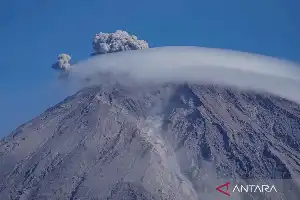
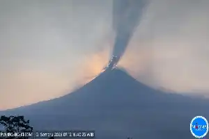
Mount Semeru, located on the border of Lumajang and Malang regencies in East Java, has shown a significant increase in volcanic activity. Throughout Friday (10/7/2026), the highest mountain on the island of Java was recorded erupting six times, with the eruption column peaking at up to 1.3 kilometers above the crater.
According to a report from Mount Semeru Observation Post officer Liswanto, the series of eruptions began at 06:29 WIB. The first eruption spewed an ash column 1.1 km high with thick intensity drifting southwest. Eruption frequency continued until 10:02 WIB with eruption column heights ranging from 500 meters to 1.3 kilometers above the peak.
Currently, the Center for Volcanology and Geological Hazard Mitigation (PVMBG) maintains Mount Semeru's status at Level III (Alert). The public is advised to comply with activity exclusion zones, especially in the southeastern sector along Besuk Kobokan up to 13 kilometers from the eruption center.
Authorities also emphasized a prohibition on activities within a five-kilometer radius of the crater to avoid the risk of incandescent rock projections. In addition, residents are asked to increase vigilance against threats of pyroclastic flows, lava flows, and cold lava flows along riverbeds originating at the mountain's peak, particularly along the Besuk Kobokan, Besuk Bang, Besuk Kembar, and Besuk Sat river basins.