The Meteorology, Climatology, and Geophysics Agency (BMKG) continues to intensify its monitoring of sea surface conditions around the Sunda Strait following a series of eruptions of Mount Anak Krakatau over the past few days. This step was taken as an early mitigation measure to detect potential tsunami threats or water anomalies resulting from the volcanic activity.
BMKG Director of Earthquakes and Tsunamis, Wijayanto, emphasized that to date, all monitoring instruments have not recorded any significant activity in sea levels. According to him, no suspicious anomalies have been found as a direct impact of the volcanic eruption.
In addition to marine hazard threats, BMKG also noted important details regarding volcanic ash dispersion. Although the impact of the current eruption remains local, ash distribution can affect visibility and air quality in the surrounding affected areas. Wind direction and speed are key factors in ash dispersion, which is currently tending to move northwest toward the Lampung region with weak intensity.
"The impacts that need to be anticipated at present are local, particularly concerning aviation and shipping activities. We continue to monitor atmospheric dynamics to ensure transportation safety in the region," Wijayanto explained.
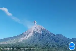
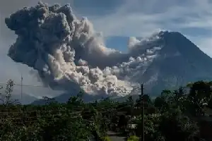
Data from the Center for Volcanology and Geological Hazard Mitigation (PVMBG) recorded that Mount Anak Krakatau experienced three eruptions on Wednesday (8/7) morning, with ash column heights reaching 100 meters above the peak. Currently, the volcano remains at Level III (Alert) status, prompting PVMBG to strongly recommend that the public, fishermen, and tourists refrain from any activities within a 3-kilometer radius of the main crater.