The coastal area of the Sunda Strait experienced a series of geological phenomena on Wednesday (8/7/2026) morning, after a magnitude 5.5 tectonic earthquake shook the region. The earthquake, centered at sea at a depth of 43 kilometers, was felt as far as Banten, Bogor, and Bali, prompting vigilance among residents along the coast.
The Meteorology, Climatology, and Geophysics Agency (BMKG) confirmed that the tremor was triggered by thrust fault movement in the subduction transition zone. Despite causing initial concern, official modeling results confirmed that this tectonic event does not have tsunami potential and did not trigger any dangerous aftershocks.
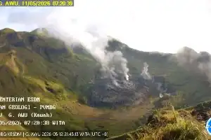
Only a few hours after the earthquake, Mount Anak Krakatau showed volcanic activity, spewing an ash column up to 250 meters high at 07:11 WIB. Despite occurring close in time, the Center for Volcanology and Geological Hazard Mitigation (PVMBG) emphasized that the eruption was purely triggered by internal magma dynamics, not a direct impact of the earthquake's vibrations.
Currently, Mount Anak Krakatau remains at Level III (Alert) status. The public is urged to adhere to the 3-kilometer exclusion zone from the crater. Disaster expert from IABI, Daryono, emphasized the importance of preparedness for residents in coastal areas, including identifying independent evacuation routes, wearing protective masks against volcanic ash, and always verifying information through official channels to avoid misinformation.