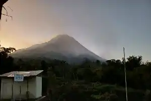
Mount Karangetang, located in Siau Tagulandang Biaro Islands Regency (Sitaro), North Sulawesi, reportedly showed volcanic activity in the form of an eruption on Sunday evening (12/7/2026) at 19:13 WITA. Based on data from the Mount Karangetang Volcano Observation Post, the eruption was recorded on the seismogram with a maximum amplitude reaching 50 mm and lasted for more than two minutes.
Observation officer Vieko Kristianse Rompas stated that this volcanic activity triggered incandescent lava flows from the northern crater peak. The glowing material was observed flowing in various directions, with flow distances ranging from 400 to 1,000 meters toward the southern, southwestern, and north-northwestern sectors. As of the time of this report, eruptive activity is reportedly still ongoing.
Relevant authorities have established an exclusion zone within a 1.5-kilometer radius of Crater Two and the Main Crater. Additionally, a sectoral extension area to the south-southwest up to 2.5 kilometers has also been declared off-limits to residents and climbers. These restrictions were implemented to minimize the risk of casualties from lava avalanches and pyroclastic flows that could occur at any time due to the unstable condition of the lava material.
Residents living along riverbanks originating from the peak of Mount Karangetang are also asked to exercise extra vigilance. The threat of rain-induced lahar floods and flash floods is a primary concern, particularly during heavy rainfall that has the potential to carry volcanic material all the way to coastal areas.