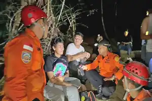
Efforts to handle the forest and land fire (karhutla) sweeping the Mount Biru Complex area in Mojokerto Regency, East Java, are still ongoing. Joint personnel from various cross-sectoral agencies have been deployed to the location to monitor the situation and prevent the flames from spreading to wider areas.
However, field extinguishing operations face severe geographical obstacles. The extremely steep and rugged mountain terrain has prevented the joint team from directly accessing the four hotspots detected in the conservation area.
Based on field data, these hotspots were identified in Regional Conservation Resort (RKW) 06, which administratively falls within Gumeng Village and Begaganlimo Village, Gondang District, Mojokerto Regency. The forest area is under the management of the Raden Soerjo Grand Forest Park (Tahura UPT).
To coordinate tactical response measures, officers have set up an emergency command post on the Bukit Cendono hiking trail. This post serves as an integrated communication center for UPT Tahura R Soerjo personnel, the Regional Disaster Management Agency (BPBD), police, and volunteers standing by in the field.
Meanwhile, the Mojokerto Police Department (Polres) has reinforced response efforts by deploying at least 10 personnel from the Patrol Unit (Satuan Samapta). Mojokerto Police Patrol Chief, Police Commissioner Assistant (AKP) Joedjono Wihandoko, emphasized that his side continues to maintain close synergy with all relevant agencies to prevent the escalation of this forest fire disaster from spreading further.